Description
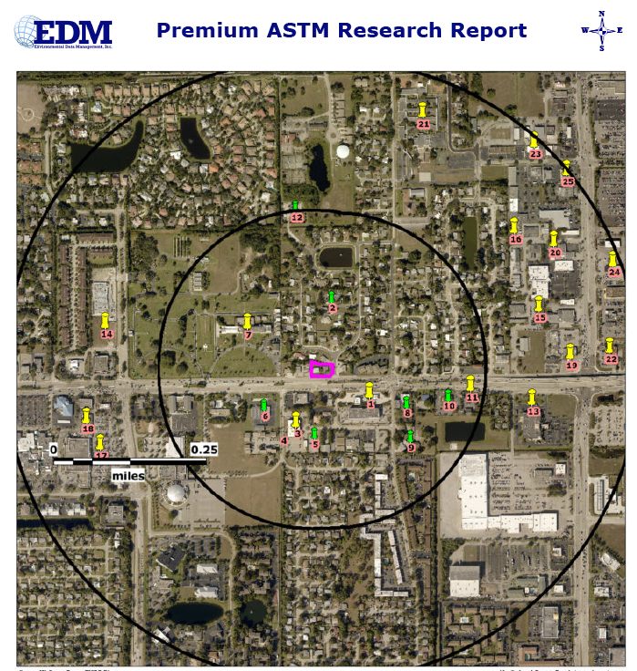
Our Premium ASTM Research Report meets and exceeds the ASTM E1527-13 guidelines for identifying Regulated Sites out to a 1/4, 1/2 and 1 Mile Radius from the Subject Property. Street Maps, HIGH resolution Aerial Photographs, Wetlands/FEMA Floodplain Maps and recent DRG Topographic Maps are used to display the location of the Subject Property and those Regulated Sites meeting our search criteria. A KMZ file is also provided so that you may view the site locations in Google Earth!
The report includes Historical Topographic Maps, current Property Appraiser data for the Subject Property and our Water Well Report which searches for Private and Public Water Wells out to 1/4 and 1/2 Mile from the Subject Property. We also provide our Historical Aerial Photograph Report (back to the 1940’s in most cases), 50 Year City Directory Research Report and our Full DRG Historical Topographic Map Report in separate PDF documents.
Regulated Sites are displayed on the maps using Color Coded and Numbered Symbols. A Summary Table of identified sites is provided showing the Site Number, Site Name and Address, Agency Listing and Distance/Direction from the Subject Property. Detailed Data for each site is provided in User friendly and Formatted Reports. Bookmarks and Hyperlinks are provided for easy navigation within the report and to provide access to outside sources of additional information.
Our Proximal Sites Summary Table is also included and lists Regulated Sites in the general area, that may be of concern, but fall outside of the search radius criteria that would provide detailed reporting.
Our Non-Mapped Summary Table lists sites that could not be plotted within our mapping system due to poor location information