USGS Historical Topographic Maps are now included with all of our Standard and Premium Research Reports!!
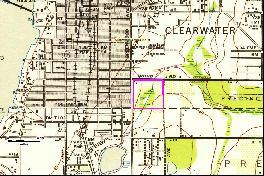
Historical Topographic Maps can be used to assess land use changes on your property and surrounding area over extended periods of time. Most areas have maps available back to the 1940’s.
EDM’s Historical Topographic maps are georeferenced so that each map is at the same scale, making it easy to note changes in historical land use. Each map displays your subject property boundaries and extends out to an approximate 1/2 mile radius.
-Note land use changes over time
-Maps dating back to the 1940’s
-Georeferenced with map Scale Bar displayed
-Included with our Standard and Premium report formats
-Full 7.5-minute quadrangle images are also available in PDF format and may be ordered as a stand alone product